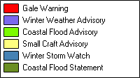
Local 7- Day Forecast for CTZ007
Northern Middlesex-
904 AM EST Wed Feb 25 2026

.TODAY...Cloudy. Snow with a chance of rain late this morning.
Snow accumulation around an inch. Highs in the upper 30s.
Southwest winds 5 to 10 mph with gusts up to 25 mph. Chance of
precipitation 90 percent.
.TONIGHT...Mostly cloudy in the evening, then clearing. Lows in
the upper 20s. Southwest winds 5 to 10 mph with gusts up to
20 mph, becoming west after midnight.
.THURSDAY...Partly sunny. A slight chance of snow in the
afternoon. Highs in the upper 30s. West winds around 5 mph.
Chance of snow 20 percent.
.THURSDAY NIGHT...Partly cloudy. A slight chance of snow in the
evening. Lows around 19. Northwest winds around 5 mph. Chance of
snow 20 percent.
.FRIDAY...Mostly sunny. Highs in the upper 30s. Northwest winds
around 5 mph, becoming southwest around 5 mph in the afternoon.
.FRIDAY NIGHT...Mostly clear in the evening, then becoming partly
cloudy. Lows in the mid 20s.
.SATURDAY...Mostly sunny. Highs in the mid 40s.
.SATURDAY NIGHT...Mostly clear in the evening, then becoming
partly cloudy. Lows in the mid 20s.
.SUNDAY...Partly sunny. Highs in the upper 30s.
.SUNDAY NIGHT...Partly cloudy. Lows 15 to 20.
.MONDAY...Partly sunny with a 40 percent chance of snow. Cold
with highs in the upper 20s.
.MONDAY NIGHT...Mostly cloudy. A chance of snow in the evening.
Lows around 10 above. Chance of snow 40 percent.
.TUESDAY...Partly sunny. A chance of snow in the afternoon. Highs
in the lower 30s. Chance of snow 30 percent.